www.gradient.cx www.woodyvalley.com www.turnpoint.de/ascent/index.php
Rules / Regeln / Info
Google Earth
Please choose the module to use
for Google Earth Display
IGC2KMZ (Most detailed, bigger size)
GPS2GE V2.0 (Many details, big size)
Simple (Only Task, very small)
Colore linea Larghezza linea
Info sull'area di volo
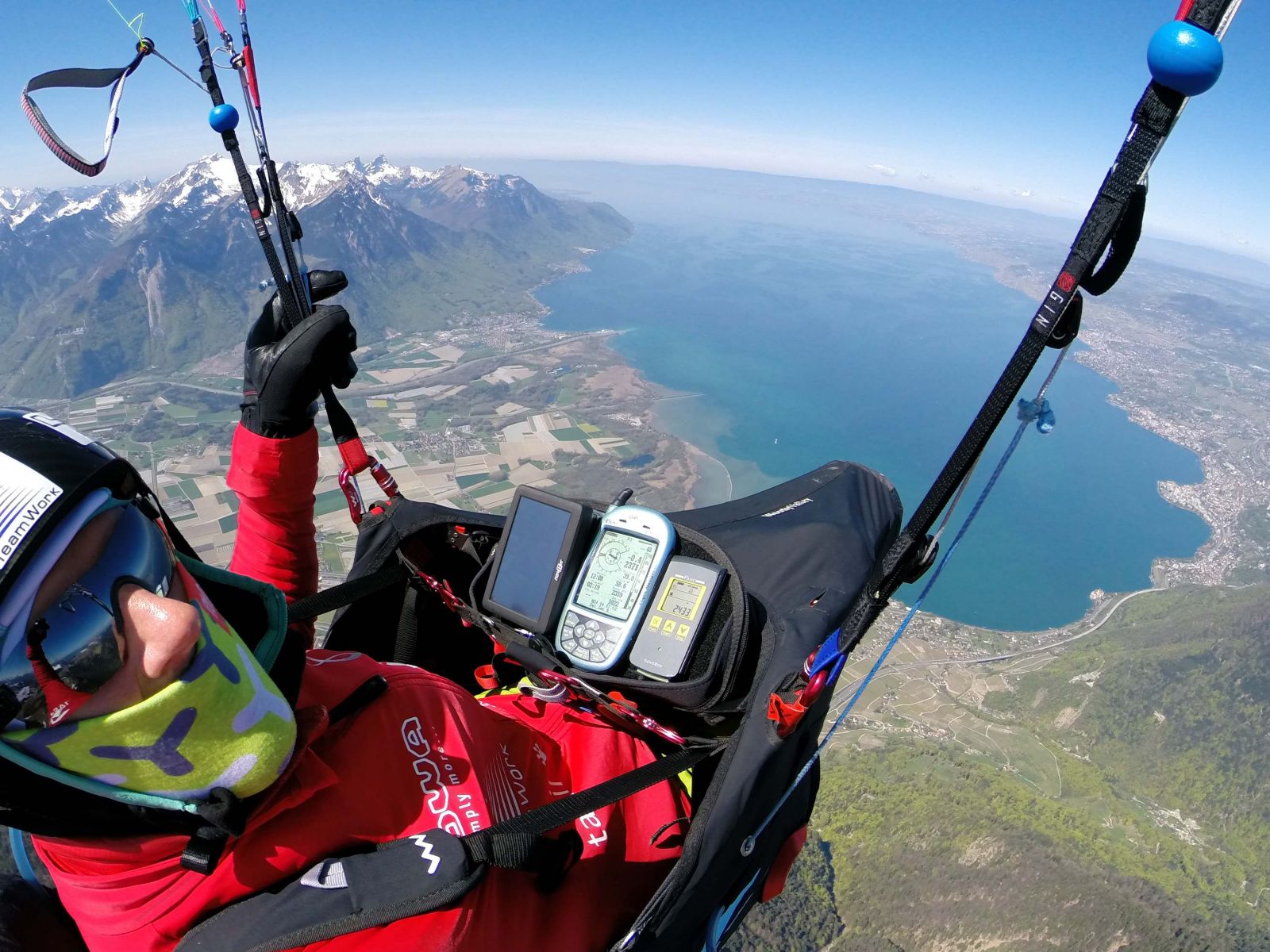
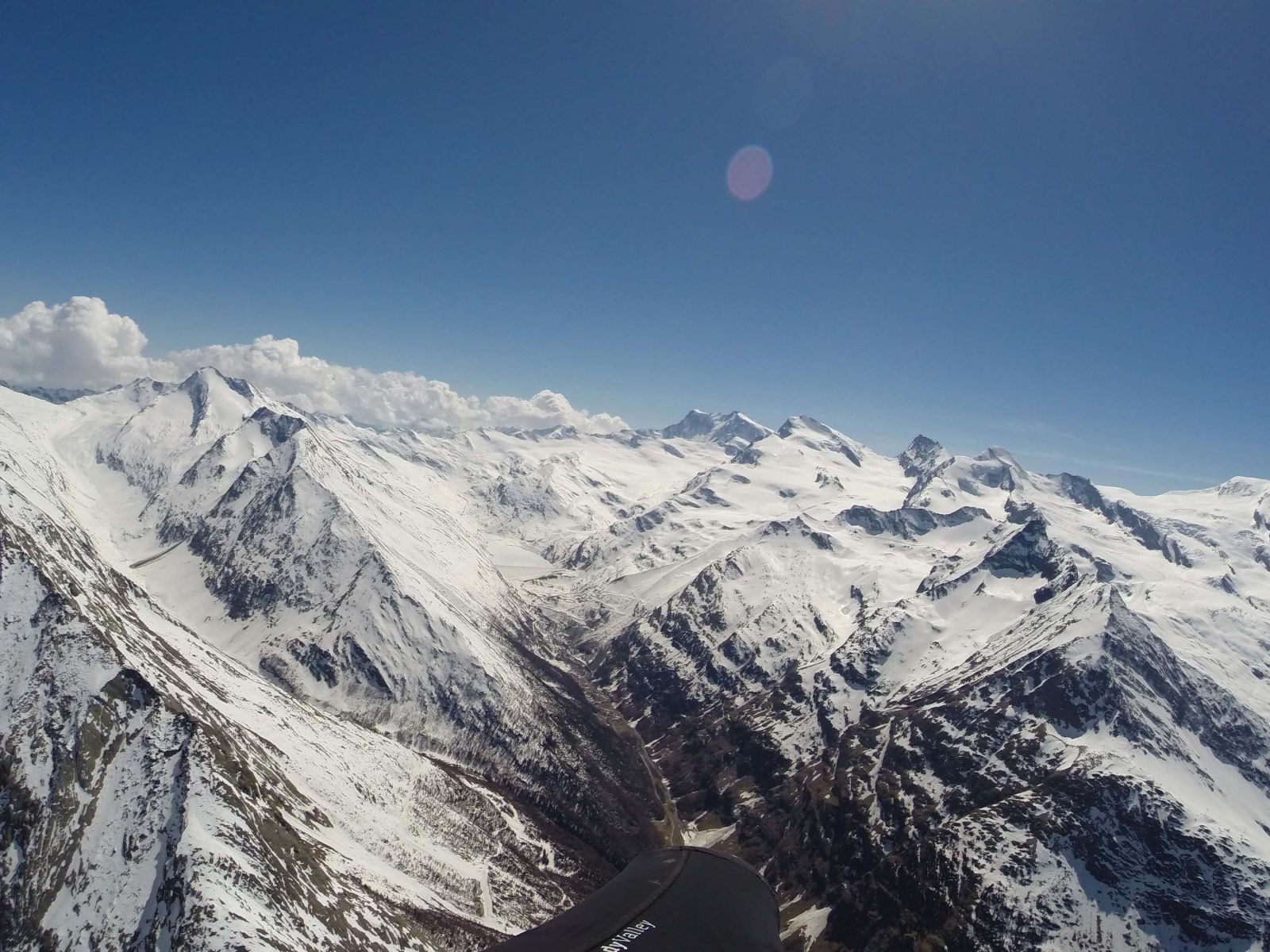
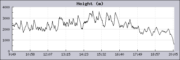
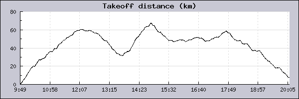
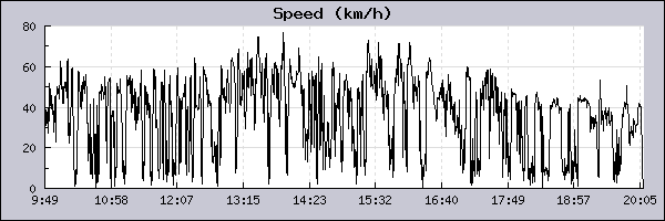
Pilota: Christian Maurer   Data: 24/04/2015
Info Decollo
Decollo
9:49:28
Atterraggio
20:09:23
Howald - CH [~5.7]
XC Info
Distanza lineare
67.6 km (6.5 km/h)
Distanza Max
119.2 km (11.5 km/h)
Distanza OLC
292.3 km (28.3 km/h)
Punteggio OLC
584.52 Airspace Violation: 5866,1027,2153,5848,1418,2150,1997,5816,1023,1421,1420,5846,1999,5818
HorDist: 2081m, VertDist:1089m, Airspace: SMH:134.825 [CLASSD] 0-2712m
HorDist: 5610m, VertDist:3447m, Airspace: SX00D9-377_LSD9 [WAVE] 0-11488m
HorDist: 5610m, VertDist:3447m, Airspace: LSD9-377 [RESTRICT] 0-11488m
HorDist: 2983m, VertDist:989m, Airspace: SMM:126.87 [CLASSD] 1615-3962m
HorDist: 2983m, VertDist:989m, Airspace: C53IN-130_INT [CLASSC] 1615-3961m
HorDist: 2894m, VertDist:536m, Airspace: LSD5-82 [RESTRICT] 0-2498m
HorDist: 259m, VertDist:1131m, Airspace: DC23BU-130_Buoch [CLASSD] 701-3961m
HorDist: 259m, VertDist:1131m, Airspace: SMA:119.62 [CLASSD] 701-3962m
HorDist: 6137m, VertDist:288m, Airspace: SX60D6-130_LSD6 [WAVE] 1828-3961m
HorDist: 6137m, VertDist:288m, Airspace: C60MEI-130_MEIRI [CLASSC] 1828-3961m
HorDist: 3653m, VertDist:1980m, Airspace: D130MEI-130_MEIR [CLASSC] 0-3961m
HorDist: 3645m, VertDist:1981m, Airspace: SMM:126.87 [CLASSD] 0-3962m
HorDist: 3199m, VertDist:318m, Airspace: C59BUO-130_Buoch [CLASSC] 1798-3961m
HorDist: 3199m, VertDist:318m, Airspace: SMA:119.62 [CLASSD] 1798-3962m
Tipo punteggio OLC
Triangolo FAI
[ Parapendio ]
Gin Boomerang 10 Boomerang 10
Info Volo
Durata
10:19:55
Max vario
7.1 m/sec
Min vario
-4.9 m/sec
Altezza massima (SLM)
3641 m
Altezza minima (SLM)
614 m
Altezza decollo (SLM)
2361 m
Guadagno quota
1280 m
Velocità massima
80.2 km/h
Velocità media
39.3 km/h
File del volo
Pagina web relativa
N/A
Info sull'area di volo