


Google Earth
Please choose the module to use
for Google Earth Display
 IGC2KMZ (Most detailed, bigger size)
GPS2GE V2.0 (Many details, big size)
Simple (Only Task, very small)
Cor da linha Espessura da linha
for Google Earth Display
IGC2KMZ (Most detailed, bigger size)
GPS2GE V2.0 (Many details, big size)
Simple (Only Task, very small)
Cor da linha Espessura da linha
Informação do local de vôo
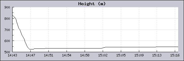
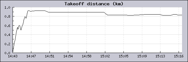
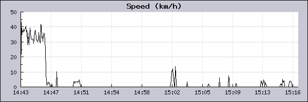
Piloto: Stefan Reinhardt Data: 06/01/2021
|
||||||||||||||||||||||||||||||||||||||||||||||||||||||||
|
||||||||||||||||||||||||||||||||||||||||||||||||||||||||
